Tuesday, December 19, 2017

30 Days Down Under - Part 8 - Auckland

Our Introduction to Auckland


The two hour flight from Queenstown to Auckland went by too quickly ... we spent the time with our seatmate, a young guy from Belgium, showing each other photos of his two week adventures on the south part of the South Island and some of the highlights of our trip.  We put our phones away, said our goodbyes, and made our way to our B&B near Mount Eden in Auckland.

The summit of Auckland's highest point, Mt. Eden, was about 1.7 miles from our bed and breakfast so we wandered over and traipsed up to see its view of Auckland - and its volcanic crater (Te Ipu-a-Mataaho - “The Bowl of Mataaho”). It's a simple bowl covered by grass, a part of which is seen here from a high point on its rim.


We're from the Pacific Northwest, so are used to volcanoes. Oregon has about 19, the State of Washington about 10 ... many of them are high, snow covered and glaciated peaks. In the state of Washington four of them are considered amongst the potentially most dangerous in the US, with one, Mt. Rainier near Seattle, in the Decade List - considered amongst the 17 potentially most destructive volcanoes in the world. (See comments about Washington volcanoes here)

Auckland dwarfs the US Pacific Northwest (in numbers, not at all in height). Auckland has between 49 and 53 volcanoes in its immediate area!!! Whereas in the northwest many are spectacular - high glaciated peaks, the ones around Auckland are much more mundane - many are barely noticeable and many have been quarried into oblivion.  One of the differences between the two areas: in the Northwest the most likely next eruptions will come from one of the existing peaks likely after warning by rumbling quake series, whereas in Auckland the most likely next  eruptions will come from a new location without  much warning   See about Auckland volcanoes here

One day we spent many hours in the Auckland War Memorial Museum - a bit of a misnomer ... it's a great collection of Maori, cultural, and natural  history, amongst other things. And it has a series of exhibits on volcanism, earthquakes, and the pacific rim ... wow, I had known the area of New Zealand was very active, but had not understood how very geologically active it was. A good article on Auckland's volcanoes is by the Ministry of Civil Defence here.

Amidst the displays was a section describing the volcanic (and earthquake) risk in Auckland and the rest of New Zealand. It also described the extensive planning that the government of New Zealand has instituted and the insurance for both earthquake and volcanoes that the government provides.  It puts to shame Seattle's lack of planning, and the paucity of reasonably affordable disaster insurance available in the US. Imagine: a nation that plans ahead of time to take care of its populace! New Zealand.

Click on any photo in the blog to enlarge it


Maori


It was the Maori and Pacific Islanders exhibits at the museum that attracted us the most.

Here's a model in the museum picturing a prototypical Maori Pa.  The Maori were competitive and warlike, with tribes fighting tribes and building pa's - fortified settlements for protection.  Mt. Eden in present-day Auckland was once a terraced and fortified pa.

The Maori were quite the opposite of the aboriginals in the Australian outback who were peaceable.
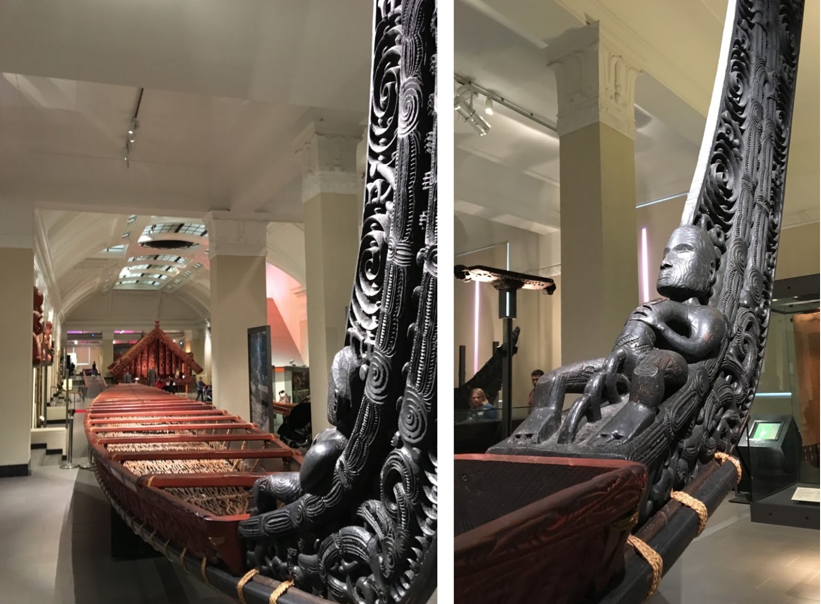
Perhaps when people are faced with a harsh environment in which survival is difficult, they are more humane and understanding of others' needs to endure and survive, than when they are in a fortunate environment that is plentiful, where they can afford the luxury of competition and greed.

Maybe that's why many people undergoing hardship tend to be so willing to help their neighbors and others.

For the most successful of the Maori's they could afford large storehouses like the one (from a fairly late vintage) in the museum.

Te Ara is an excellent site for New Zealand's history, culture, and politics including that of the Maori's, at https://teara.govt.nz/en You could (should) get lost for months exploring it in much more depth than I could ever manage.


Maori masks, carved in wood or soapstone, were used to honor the dead; they reproduced the ta moko - the markings - that had adorned the ancestors.

For a fascinating read see the story of Whakairo - Maori carving here.

And for an even more fascinating read, see the story of Ta Moko, Maori "tattooing" here. The word "tattooing" is a bit of a misnomer. The technique used was not at all like a modern day tattoo, nor did it feel as gentle as tattooing when it was applied.  The grooves were chiseled into the skin using chisels producing deep incisions in the skin rather than the pinpricks of modern-day tattoos.  I wonder how popular tattoos would be today if the same methods were used.

If (when?) I ever get a tattoo I'd pick a Maori design, at least as close to one as Maori traditions allow. But I certainly would not want it done the Maori way.


Other fascinating articles about Maori culture are about Maori kites here (yes, they flew kites), and their religion here, and what some Victorians would prudishly call their morals here (the latter being very apropos to same sex marriage that the people of Australia just voted 61.6% to 38.4% to allow.)


The museum also contains exhibits of polynesia and the Pacific Islands, to which New Zealand is bound both geographically, historically, and culturally.

New Zealand's population as of 2013 was 74% European, 14.9% Maori, 11.8% Asian, and 7.4% Pacific Islanders. (per Wikipedia)

And with that, we're off to an island.


Train to Waiheke Island


Early one morning it took us only a little over 10 minutes to walk from our B&B in the Mount Eden neighborhood, past Eden Park (Auckland's major stadium where the All Blacks play - that rugby team is New Zealand's pride - their stuff is sold everywhere in NZ, just simply everywhere, you can't escape it) to the nearby Kingsland rail station.  There are convenient, new, clean, fast trains roughly every 20 to 30 minutes to Britomart, the major downtown rail station at the harbor.

Like in Sydney, a massive rail terminal and pedestrian precinct was under construction along the harbour.  Somehow we found our way through the construction (the wayfinding sucked in comparison to Sydney) to the old but classic brick Ferry Terminal building.

From there we caught Fuller's ferry for its 40 minute trip to Waiheke Island. It gave us a good view of downtown Auckland and its ferry terminal - a scaled down version of Sydney's Circular Quay.

(map from Open Street Map under its open license)


Our destination was to visit a close friend who lives on the far east side of Waiheke Island in her family's home, which the family had first built in about 1900.  At that time it was exceedingly remote - the only way to the home was by boat or horseback (or trekking) from the western end of the island .


Waiheke Island is undergoing a quick change - our journey the length of the island was a journey through that change. The ferry docks near the western end of the island.  That end seems a bit like Sausalito or Tiburon on the north shore of San Francisco bay - manicured, pleasant, with any property likely costing a fortune. Taking the road eastward one passes a mix of exurban sprawl - remaining older homes and stores, many seeming from the 50's and 60's when lots of young people were living cheap away from the city, amidst many new and obviously expensive houses and condos.

As the road proceeds west it becomes a bit more rural, with several wineries set amongst their vineyards - a favorite Auckland destination for a day of sipping wine. Eventually the main road comes to Onetangi Beach. From there smaller roads continue east to a mix of parks with popular day hikes and various rural properties, both old and new.

Throughout the island there are frequent views over the multi-fingered coastline and its  inlets and bays.


The view from our friend's yard's gate. The house was down a path about 50 yards from the end of her shared rough drive, which required a 4 wheel drive steeply wind its way up to the road.


Friday, December 8, 2017

30 Days Down Under - Part 7 - Queenstown

Flying to Queenstown

Image from AJ Hackett Bungy Queenstown website
In Sydney's airport we breezed through Australia's exit controls, a mirror image of their entrance controls: an automated passport reader that tracked who we were and verified that their visa was in order. Then we stepped to an automated camera that verified that our faces matched our passport, and we were through.

Simple, fast, efficient ... regulating both entrance and exit.

We were soon flying our way to New Zealand for 3 1/2 days in Queenstown.   (Our flight wasn't tethered like in the adjacent Hackett bungy ad.)

Mid October is early spring in Queenstown. We knew we were pushing the weather, relying on luck; it can be dicey that time of year.  The highest probability for the entire year for rain in Queenstown is on October 14.  We would arrive October 15!

According to Weather Spark (my favorite weather site when seeking to easily see average weather patterns - they have lots of easy-to-read graphs for each of the major elements of weather, showing not just the month like most sites, but the days within each month.  https://weatherspark.com/): For the days we'd be there in mid October the average high temperature is about 55 F, 51% of the days are mostly cloudy or worse, 46% of the days have rain, and it's usually windy.

Queenstown is known as an active outdoor place; most of our plans revolved around that. And we were planning, amongst other things, to do a boat trip in Milford Sound where it rains 61% of the time in October (see here )

As the plane approached the mountains surrounding Queenstown we looked out at the threatening weather.  At Queenstown you get up-close-and-friendly with the mountains real fast; the landing approach for the plane was down a narrow valley, mountaintops above us with their flanks pressing close on each side.


Arriving

After we unpacked, when we walked into town and along Lake Wakatipu's beach, we were pleasantly surprised. Being from Seattle the weather seemed quite passable.

There were still lots of clouds but some sunny breaks too. It was windy with quite a chop on the lake - even some whitecaps, but we (and some of the people on the lake's beach) were warm in our jackets - some seemed not to need them. And best of all, no rain seemed to threaten.


During our walk the Lady of the Lake greeted us.  She was a beaut!

A working steam-powered steamship, the TTS (twin screw steamer) Earnslaw had been contracted in 1910 to be built in Dunedin NZ.  When completed she was dismantled and shipped by rail to Kingston, one of the other towns on Lake Wakatipu, and reassembled, beginning service in 1912.

Originally serving, along with other boats, as the sole means of transportation between communities on the lake, she now ran several times daily serving tourists. We passed it up; we were more interested in other things ... we'd save such things for when we were older and less active.


When planning this trip down under we had debated whether or not to come to Queenstown, or skip it in order to spend longer times at some of our other choices.

One of the delights of travelling is to experience alien environments ... a foreign culture with a different language ... or an environment not at all like home like the Australian outback and the red center, or the Daintree Rainforest, prehuman epochs old ... or best of all, to explore deeply into some specific thing that is a passion for you.

Queenstown, Fjordland, and their environs were none of that ... not alien at all.  Coming from the US/Canada Northwest, we are imbued with the fjords of the Salish Sea and inland passage; we have years of familiarity with playing in the mountains hiking, skiing, and when younger, roped scrambling across glaciers and to the summit of some of the northwest's glaciated peaks.  And I'd lived for several years in Whistler, with its mix of adrenalin junkies scraping by and its wealthy tourists, just like Queenstown. Did we really want to travel so far to see our own backyard?

Happily, we decided yes.  We have a passion for mountains. Though we would have neither time nor equipment with us for hiking some of the surrounding renowned multi-day treks, the next day resonated with our cores.

Milford Sound

With only one day to get to Milford Sound and back, the choice was to drive (too tiring), fly (too weather dependent), or take a bus. After researching the options, over a month ahead we reserved spots on the Milford Sound BBQ bus https://bbqbus.co.nz/.

It was a great choice - a small bus, a personable driver, and a limited amount of passengers; when we stopped at sights we didn't overwhelm the place like the (too many) large buses.  Our driver used his skill to time us to be at viewpoints between the huge buses.

Milford Sound is the destination that gets all of the accolades, but the drive to Milford Sound is equally spectacular.

It was a scenic drive along the shores of Lake Wakatipu looking across it at mountain peaks where spring snow lingered, then through a broad farming valley full of sheep (in New Zealand sheep outnumber people 7 to 1), and then upwards into the sharp, craggy, wet, glaciated mountains.


There was a coffee shop stop to grab a quick bite (our little group amidst throngs from the big buses) and many scenic stops enroute where we had a chance to take some short walks.  If we would have been 2 weeks later, when the BBQ bus returned to its summer schedule, we would have had a BBQ and picnic at one of the stops. But October was still their winter season - we had our BBQ on the boat on Milford Sound.

The first scenic stop was at Mirror Lakes, where the farming valley had changed to a sub-alpine valley and the mountains began to surround us.


Click on any picture in the blog to enlarge it


As we approached the road's summit the spindrift that the winds were blowing off of Mt. Tutoko, and the clearing skies that the winds were blowing in, held promise for the weather at Milford Sound.


Promise fulfilled.
When we got to Milford Sound the weather - and the surroundings - were spectacular; a mystical place.  Best of all: we had happened upon one of the very few sunny days in a year.

The Sound (actually, technically, it's a fjord) is surrounded by sheer rock walls off of which plunge waterfalls - too many to count. It's the sort of place where one would expect a mythical sorcerer's castle to perch high up on a ledge shrouded in mist and clouds.

One of the benefits of being on a small bus: we went on one of the smaller cruise boats on the sound.  Our boat's size enabled it to nose in under several waterfalls. The people standing out on the bow stumbled over the raised boat-door threshold and each other and to get inside, trying to avoid the fall's onslaught drenching where they had been standing and photographing ... I, with my iPhone's camera, scurried around to the protection of the outward side.


Milford Sound opens onto the Tasman Sea near where the Southern Ocean and the Indian Ocean collide - where winds can hurl waves like earthquakes against New Zealand's cliffs.
But today it was serene. Today one could imagine a comfortable sail a little over 1,000 miles directly west to Tasmania, or by turning left, a little over 1,700 miles to the nearest coast of Antarctica. (measured off of Google Earth)


Queenstown

The next day was one of our down days. Because of the flying petri dish's respiratory thing we found we needed to relax between adventures, so we spent the day exploring the town.

Queenstown is, above all, an outdoors place.  An outdoor place both for young adrenalin junkies living on god-knows-what, sedate wealthy grandparents passively enjoying the scenery, and every life-style in between.

It's crowded with backpacker hostels and crowds of exuberant youths celebrating their adventures and preparing for the next. Coexisting, intermingled amongst them, are luxury resorts and condominiums - you can spend as much, and flaunt as much, as you want (The most exclusive places are in the countryside outside of town.). And there are kegs of restaurants and bars ... from relatively inexpensive (even those cost more than in many places) to extravagant ... lots of places where the entire human zoo meets and mingles, and lots of places where those on one end or another of the human spectrum would never be seen.

There are four major ski areas ("ski fields" in Kiwi parlance) surrounding Queenstown (five counting one that is further away) - the season had only recently wound down.  Dozens of stores had their ski season closeout sales on. Many displayed expensive ski clothes that no self-respecting skier could ever, or would want to, afford (even upscale boarder clothes? Things have certainly changed from the days that ski areas forbad those dangerous, grungy, and smelly boarders who slept through the winter in their tents, vans, or cars.)

It is a mecca for hiking ("tramping" in Kiwi parlance) and climbing, the jumping-off place for dozens of multi-days tramps and for dozens of short walks. And it's a mecca for kick-ass mountain biking - and for more leisurely biking to the nearby Gibbston Valley wine country. Outdoor stores abound for every price range.

And, of course, it's a mecca for bungy jumping. A. J. Hackett and Henry Van Asch got the idea from "land-diving" by natives in Vanuatu using vines. They, with a group of Kiwi scientists from the university, developed artificial bungy cords. In 1987 AJ jumped off the Eiffel Tower to demonstrate. (Hey guys! Look! Exciting stuff!) In 1988 they opened the world's first commercial bungy site here at Queenstown at Kawarau Bridge.  Now they have three sites in Queenstown plus other thrills, along with some competition. The bungy jump shown in the round picture at the start of this blog is from that small green platform shown in my picture immediately above. Want to jump tandem with a friend? Nude? You can arrange for that here.

Everyone should take the Skyline Gondola for its panoramic views of Queenstown and Lake Wakatipu (or to ride the luge, or to bungy, or to hike further up.)  While on top we talked with one of the gondola attendants,  a young guy from the UK in New Zealand on a gap year. He'd just that week arrived in Queenstown, temporarily living in a hostel until he could find a more permanent place to live ... gotten this job within days.

And there's every type of boating you can imagine, and some types that you probably can't imagine.
And there are plenty of waterfront promenades and walking paths, places to peaceably stroll while taking in the view.


And for those who feel the need, there's a place to privately regret yesterday's sins.


Bicycling

The next day we were up bright and early for a day of bicycling. We had arranged to rent bikes for a day from Queenstown Bike Tours - located in Arrowtown http://www.queenstownbiketours.co.nz/ to ride from Arrowtown into the wine country in Gibbston Valley.  It's not very far, only about 15 km (9 miles) to some of the wineries. Our mid-70's year old bodies are relatively fit and used to cycling so the ride was easy.

map from Queenstown Bike Tours website

The owner's wife picked us up in our place in Queenstown, then went to another hotel to pick up another biker. We waited. And waited. She phoned him, no answer. She went to the front desk and phoned a second time; he hurried out, apologizing. Then we went to pick up his buddy at another hotel, where we waited and waited again. At long last we drove the faster, back, way to Arrowtown

While they were getting other people set up we decided to walk around Arrowtown ... it's quite a tourist stop, an old preserved but still active town of wood storefronts dating from the gold rush period.  It was only passably interesting, like many of the old gold mining towns in the western US.

They had bikes picked out for us and ready to go ... nice Specialized mountain bikes.  My legs are slightly shorter in proportion to my torso than most, so the bike was just a small bit too tall for me. They were going to change it out for me but it was getting late and I wanted to get going.  It was fine, I just needed to treat the top tube with respect. They gave us maps and some explanation and we were off.


We rode alongside the Arrow River on gravel and compressed soil bike trails most of the way, except a couple of short segments on country roads. The trail crossed the river five times on suspension bridges.
We finally arrived at a sixth suspension bridge, the Kawarau Bridge over the Kawarau River where commercial bungy first started. We joined the many others watching.


Bands to which the bungy rope is attached link the jumper's feet.  The attendants (here in black - securely tethered) help the jumper (here in red) shuffle their feet onto a small platform.  After the the jumper screws up their courage and jumps (regardless of whether they dive or  just jump, they end up head first when the rope goes taut) they spring and pendulum up and down.  After the elastic motion finally subsides attendants in a raft hold a long pole up for the jumper to grab to be pulled to the raft.

I badly broke both my tibia and fibula skiing a few years back, so am a bit cautious about stressing my legs.  But if it were before that I wonder if I would have jumped (nude?).  I would hope so.

We eventually rode on into the wine growing Gibbston Valley.  We rode on the trail above the river into the valley for a bit, then returned to the Gibbston Valley Winery, carefully closing the gate behind us.  The table cloths, menu, and price didn't quite match our bike-riding-intentions, so we walked across their courtyard to their Cheesery.  It was more informal there, and though it didn't seem to have as wide a choice of wines, we had an enjoyable lunch of various cheeses, crackers, bread, and wine.

By mid afternoon we phoned back to QT Tours to arrange for their pickup. The owner met us with his van and bike trailer back at the bungy bridge. I complemented him how good a condition he kept his bikes in. (Incidentally, for those of you who are U.S. cyclists, a word of warning lest you fly over your handlebars in a quick stop: in Australia and New Zealand it seems most bikes have the front brake's lever on the right handlebar.) He drove us back into Gibbston Valley to pick up a van-full of cyclists and bikes at various wineries and a tavern to return them to Arrowtown ... we were the only ones who continued back to Queenstown.

On the way back he told us about QT Bike's history ... although much of their business was from Queenstown (they once had a shop there) they loved the smaller town's laid-back atmosphere and more peaceful life, so he and his wife had elected to run their business in Arrowtown.

I commented to him how, on our trip to Milford Sound when driving past the farmland, and again in the countryside between Arrowtown and Gibbston when we had been biking, and especially now along the back road between Arrowtown and Queenstown, we had passed so many farms where the farmland, although delightfully pastoral, seemed incapable of supporting their farmhouses which were mansions.  He replied that the farms didn't support the mansions; it was the other way around. The super-wealthy from around the world were buying the farms as huge private compounds.

That evening we reluctantly packed, knowing that our next stop, Auckland, would be the end of our trip (It will be in the next part 8 of my blog.)

On the plane we were seated next to a young guy from Belgium. He had spent several weeks exploring the beaches and mountains of the South Island, variously sleeping in his rental car, in a tent, or in hostels. It must have seemed a magical world to him compared to his home in the low-lands of  Europe. We all showed each other our photos on our phones and talked about our trips ... the flight went by too quickly.

Random Musings - Boltholes

It's no wonder that New Zealand, with its unpopulated mix of pastoral expanses and sharp, craggy mountains shrouded by mist and clouds, is the filming location of so many movies like The Hobbit, The Lord of the Rings trilogy, and The Chronicles of Narnia.

There is a long tradition in human history of mystical worlds both in the past and in the future ... of pastoral and friendly worlds threatened by destruction accompanied usually by darkness and smokestacks belching, and greediness and violence  ... foreboding castles high up on ledges shrouded in mist and clouds, ruling with an uncaring fist.  The tradition, so common amongst many cultures, speaks to responses deep in the human psyche about good and evil and the battle against greed.

That pastoral and other-worldly and exciting environment of New Zealand is one of the things that has attracted explorations by young backpackers and exuberant thrill seekers, and in their footsteps,  by the mass tourists like us. It has also attracted others.

In "part 6 - Hobart Tasmania" I mentioned that Hobart reminded me of Eugene Oregon in the 1960's and early 1970's: Lots of denim. Lots of wool. Lots of foul weather gear. Lots of art.  Lots of crafts. A place where many young people could attempt "getting back to the earth". Parts of New Zealand still has hints of the remnants of that.

New Zealand also reminds me of Whistler Canada in the 1970's and in the early 1980's: a place at that time with young people trying to be self-sufficient, surviving on scraps so that they could experience life amidst the magnificence and the challenges of our planet while escaping the pressures and smog of the cities.

But like the 1960's, 70's and 80's, those times are disappearing, or have disappeared, fast. Tasmania a bit, but more so Whistler Canada, and especially New Zealand are now attracting the very utmost wealthy in the world.

I mentioned in "part 6 - Hobart Tasmania" that in the 1830's and 1840's Port Arthur was a prison with walls, within a prison walled by dogs staked at Eaglehawk Neck, within the prison of Tasmania walled by water, within a prison of Australia walled by oceans. The end of the earth.

In the 2010's Australia, Tasmania and New Zealand seem more like castles, shrouded in mist, surrounded by  thousand-of-miles high walls of the oceans' water.  Throughout Australia and New Zealand we heard strong comments, and saw strong wording in the newspapers, about the amount of the world's super-wealthy buying large tracts as private compounds where they could enjoy clean air and clean water and an idyllic setting, but which could also serve as "boltholes" to where they could bolt if need be if the pitchforks rose up, or if the missiles flew - where they could bolt the doors shut.

"At the Republican party convention in Cleveland last July [2016], Trump donor Peter Thiel declared himself 'most of all, proud to be an American'. So it came as something of a surprise for New Zealanders to discover that the PayPal co-founder and Facebook board member had become an honorary Kiwi – joining a growing band of wealthy Americans seeking a haven from a possible global apocalypse.

"... By the time of his appearance at the Republican convention, Thiel had already bought 193 hectares of pristine South Island land using his rights as a Kiwi."


"News this week that Peter Thiel, co-founder of PayPal, was among 92 applicants secretly granted New Zealand citizenship outside normal procedures is focusing attention on the influx of wealthy migrants to the South Pacific nation. This follows an article in the New Yorker that pinpointed New Zealand as a favoured destination for rich 'survivalists' preparing for apocalypse."
From the article "Self-sufficient boltholes tempt global super-rich to New Zealand"
in  The Financial Times, Feb. 3, 2017

The article that spurred the above articles was in the New Yorker on January 30, 2017:  Doomsday Prep for the Super-Rich by Evan Osnos; it was succinctly summed up in its subtitle "Some of the wealthiest people in America—in Silicon Valley, New York, and beyond—are getting ready for the crackup of civilization.

There are so many quotes from that article that are worth pondering, but I'll mention one passage that stands out:

"By January, 2015, [Robert A. Johnson, formerly a hedge fund manager, now head of a think tank, the Institute for New Economic Thinking]  was sounding the alarm: the tensions produced by acute income inequality were becoming so pronounced that some of the world’s wealthiest people were taking steps to protect themselves. At the World Economic Forum in Davos, Switzerland, Johnson told the audience, “I know hedge-fund managers all over the world who are buying airstrips and farms in places like New Zealand because they think they need a getaway.

"Johnson wishes that the wealthy would adopt a greater “spirit of stewardship,” an openness to policy change that could include, for instance, a more aggressive tax on inheritance. “Twenty-five hedge-fund managers make more money than all of the kindergarten teachers in America combined,” he said. “Being one of those twenty-five doesn’t feel good. I think they’ve developed a heightened sensitivity.” The gap is widening further. In December, the National Bureau of Economic Research published a new analysis, by the economists Thomas Piketty, Emmanuel Saez, and Gabriel Zucman, which found that half of American adults have been “completely shut off from economic growth since the 1970s.” Approximately a hundred and seventeen million people earn, on average, the same income that they did in 1980, while the typical income for the top one per cent has nearly tripled. That gap is comparable to the gap between average incomes in the U.S. and the Democratic Republic of Congo, the authors wrote.

"Johnson said, 'If we had a more equal distribution of income, and much more money and energy going into public school systems, parks and recreation, the arts, and health care, it could take an awful lot of sting out of society. We’ve largely dismantled those things.' "

I remember growing up in small towns. The most wealthy and the poorest went to the same public schools. To me, it's not important that they were public schools.  The thing that was important is that we all went to the same schools.  As kids of course we all formed our cliques.  But we all knew each other.  We all talked and played together.  We all understood each other. Our community had a common bond. Nowadays private or charter schools are hailed by some as ways to improve education, and they may well improve parts of education.  But at immense costs.  They drain funds away from public school, but far worse, they divide us ... they divide our kids ... we don't get to know each other and empathize with each other ... the sense of community and the common good gets lost ... for generations.

It seems to me that at an increasing rate of speed modern medieval castles are being built on hilltops, complete with their own faithful churches and freedom for those within the walls, all protected within their high walls. From there, it's hard to see, or understand, or empathize with those who produce the food and repair the roofs and walls, the masses of serfs below.  It worries me.  Are we reverting to wild animals' survival of the fittest, with none of the  morality that differentiates us from wild animals?

But looking out on the spring fields of New Zealand, on its empty beaches, its persevering rocky headlands, and its soaring mountains - all of them similar to America's Pacific Northwest, I can't help but feel eventual hope. In The Lord of the Rings Frodo Baggins and his fellow Hobbits went through dark, dangerous, harrowing times, like those that periodically transpire throughout history. But the world survived its various dark ages and prospered. And Frodo Baggins and his fellow Hobbits survived and eventually triumphed over the Dark Lord Sauron.

I hope that my faith in humanity, and in democracy, is well-placed. And hopefully an impetuous and fearful hand doesn't push the button.

But enough of that. New Zealand is too much fun to be morose.  Next stop, Auckland. And then back to our comfortable home.


Friday, December 1, 2017

30 Days Down Under - Part 6 - Hobart Tasmania

Seals?

Have you ever had your luggage delivered by a seal?
Thanks to one of the lesser of the many unique and curious things about Tasmania, I have (sort of).

Melbourne is on the north shore of  Bass Strait, which separates mainland Australia from Tasmania.
Bass Strait was famous from 1798 into the 1810's and a very little beyond for its sealing industry (is "industry" the right word?). Huge amounts of fur seals lived on Bass Strait's shores and islands - a great resource for the seal and whale oil industry and hat makers of the UK and China.  The predation on both adults and pups was quick and lethal - within 10 or 15 years few were left.  Harvests are bound to collapse when little seed is planted  (a very short summary here). It was repeated a short time later on Macquarie Island, a remote Tasmanian island off towards Antarctica (see here).


Mind you, a few of the seals' descendents have found ways to retaliate, like this seal squashing a car.
But their population's recovery hasn't been quick, so Tasmania protects them (see here).

A ferry runs between Melbourne and Tasmania, but since our trip covered a lot of ground (and water), and since the ferry takes 11 hours and lands at Devonport on Tasmania's north coast - a long way from Hobart on the southwest coast, we flew to Hobart.

Upon landing at Hobart, we walked down the stairs from the plane, crossed the tarmac, walked through a (temporary?) shelter/corridor offering protection from wind and rain, entered the small but sparkling modern terminal, and went to the baggage area.  And there we met our seal, announcing the arrival of a new planeload of bags.

Sleeping, Eating, Drinking

We caught a taxi into our hotel, the RACV Hobart.  The RACV is Australia's equivalent of the AAA (American Automobile Association) - and the RACV has hotels and resorts in a few places around Australia.  Because Ginny is a member of the AAA we qualified for their rate discount.  It was the nicest hotel we stayed in on our trip, and one of the least costly ones. (Though to help you match expectations, 3 star is about the best we usually go - we're not 4 star people ... we'd rather spend more on experiences than comfort or things.  When I walk by a backpacker hostel I often feel a pang of envy)

A few things we really enjoyed at the RACV Hobart:
The large windows in the room didn't have drapes.  Rather, they had folding doors ... a great idea that we hadn't seen before ... much easier to keep clean and longer lasting.

The included breakfasts were great. Ahh. Bircher. Everywhere in Australia that we ate breakfast, one of the selections always included Bircher. We'd never heard of it before. We loved it. It seemed to be a mixture of muesli, a bit of fruit, and a very runny yoghurt and/or very milky cream. It became our favorite part of breakfast.  (We also tried marmite. Sorry Australians. Never again.)

The third thing I liked about the hotel: its restaurant and its bar introduced me to Tasmanian whiskey.  Tasmania seems to have raised a good crop of local distillers - no need to afford Glenfiddich here.  I don't drink much; it's rare when I have a beer or anything harder. But when we go out to eat I'll usually have one drink of something: a glass of wine, or a glass of dark beer (Australia didn't seem to have much dark beer), or a cocktail, or rarely, a double shot of whiskey neat. Tasmanian whiskey.

Hobart


Hobart is comfortable.
It's only a little bigger than Eugene Oregon where I went to university, and like Eugene, it's very laid back. Lots of denim. Lots of wool. Lots of foul weather gear. Lots of art.  Lots of crafts.

It has an old feel about it, with block after block of gracious old sandstone buildings, some dating back to the  sealing & whaling days, mixed in with newer buildings of every era.

Bike racks: Artistic & functional


Me in Salamanca Place


Hobart is in large part a workingman's town with a large nickle mine, a port and all of the muscular industry that goes with, including many working fishing boats.


Click on any photo in the blog to enlarge it


When we were walking along the docks we came to this two-masted sailing ship with its accompanying sign. Sponsored by a number of civic organizations it enables refugee youths in Tasmania to join experienced Tasmanian youths as mentors to sail the vessel.  Later in our trip we talked with someone who was in Hobart only a couple of days after we were. He had taken a photo of the ship out in the harbor with the youths up in the rigging.

What a great way to welcome and integrate refugees into a country.

Antarctica

 Hobart is one of the major supply points for Antarctica, the three major supply points for it being the southern tip of South America  (Punta Arenas, Chile and Ushuaia, Argentina), New Zealand (Christchurch), and Australia (Hobart)

Aurora Australis, an Antarctica supply vessel
Australia deserves lots of credit regarding Antarctica.

After lengthy multi-national negotiations, an international treaty was signed in 1959 regulating and formalizing activities in Antarctica, the "1959 Antarctic Treaty".  It created a loose structure that has since periodically been supplemented and modified by additional agreements. (See a summary here)

In 1988 representatives of 33 nations agreed on a framework permitting and regulating mining and mineral extraction in Antarctica, the Antarctic Minerals Convention (also known as the Wellington Convention). In 1989, Prime Minister Hawke of Australia announced Australia's objection.  As a result the agreement was never ratified.

In its place, after another set of lengthy negotiations another international agreement was enacted, the "1991 Protocol on Environmental Protection to the Antarctic Treaty", also called "the Madrid Protocol".  It prohibits mining  and "... provides that protection of the Antarctic environment and dependent and associated ecosystems and the intrinsic value of Antarctica must be fundamental considerations in the planning and conduct of all human activities in Antarctica."  http://www.antarctica.gov.au/law-and-treaty/the-madrid-protocol

But ... it's important to keep watch.
Not all nations have agreed to the 1959 Antarctic Treaty and its subsequent annexes. A treaty is only as strong as the good faith and willingness of its signatories to abide by it. And the Madrid Protocol has a provision to revisit the provision about mining in 50 years, in 2041.

Salamanca Market


Absolutely, if you are in Tasmania, be in Hobart on Saturday to attend the Salamanca Market.

It's huge (and it's crowded). The largest market I've ever been to (and I've been to a lot). It was full of everything ... the full gamut of any market ... it brought back memories of when in college in the late 60's and early 70's I used to sell lemonade and with an ex, her pottery, in what were then called "Renaissance Faires" in Oregon.  One thing that particularly caught my eye ... even though I didn't need it I almost bought one: a beautiful thick heavy hand-tooled leather belt for about 1/3 the cost of an equally heavy but untooled belt I got earlier this year from Filson's in Seattle.

And one thing there caught both my eye and my billfold: Jamie Maslin was selling his book "The Long Hitch Home, Tasmania to London on a Thumb and a Prayer." The subject alone would have enticed me to buy it. But when I saw the extreme opposites praising it (Noam Chomsky: "Very well done. Arouses many poignant memories" and Roger Stone: "Travel writing as it should be") I couldn't resist. I got him to sign it for both me and my long-time best buddy from college days - we never got it together to take a trip of our dreams like that.  I was going to read it and give it to him when we skied together this winter in Oregon. But I stupidly texted him about the book and the f-er bought himself a copy before I got home.

MONA - Museum of Old and New Art

MONA has become one of the major attractions in Tasmania. Don't miss it (even though some may be offended by parts of it). Link to MONA here

Click on the photo to enlarge it
MONA is a collection as untamed as much of Tasmania is said to be. A collection of everything.  As its name says, both old and new art, but also far beyond art. Things from everyday life.  Things that have meaning. Things representing the full range of human life: the spoken and the unspoken: passion, thought, fear, suffering, hopes, visions.

The New Yorker  magazine ran a review of it "... mona begins to feel like a mashup of the lost city of Petra and a late night out in Berlin. Everything about it is disorienting and yet somehow familiar, from the high-tech tropes, the low-culture babble, the black humor about so much that is so serious, the attention to aesthetics in a museum unsure if beauty exists or, if it does, if it matters." (See the review here)

You get to it most easily by boat. (Warning: if you can't handle the seriously long flight of stairs up from the boat landing consider taking an auto or bus to it.)

MONA is carved deep into sandstone which is left raw and exposed throughout much of it.

One of the first things you'll see inside is this impossibly long table set for a banquet that never happens. To get a sense of scale, see the two attendants setting the flower centerpieces that are periodically changed. (They're near the back to the left of the table.) And compare them to the height of the magnificent sandstone wall.

One of the pictures below is a sculpture of shards of metal and glass - nearby are some cobbles from the passenger's platform from the Hiroshima railroad station and a large collection of hand-rubbings from it.

The entire human experience is fair game here at MONA, like it or not.
(I probably shouldn't show on here a few of the x-rated exhibits ... including two of my favorite pics)

National flag of Angelina


Why We Came to Tasmania

"In 1787, the twenty-eighth year of the reign of King George III, the British Government sent a fleet to colonize Australia.

"Never had a colony been founded so far from its parent state, or in such ignorance of the land it occupied. There had been no reconnaissance. In 1770 Captain James Cook had made landfall on the unexplored east coast of this utterly enigmatic continent, stopped for a short while at a place named Botany Bay and gone north again. Since then, no ship had called: not a word, not an observation, for seventeen years, each one of which was exactly like the thousands that had preceded it, locked in its historical immensity of blue heat, bush, sandstone and the measured booming of glassy Pacific rollers.

"Now this coast was to witness a new colonial experiment, never tried before, not repeated since. An unexplored continent would become a jail. The space around it, the very air and sea, the whole transparent labyrinth of the South Pacific would become a wall 14,000 miles thick."

Thus begins The Fatal Shore by Robert Hughes. The epic of Australia's founding. It brings to life the lives and interactions of the convicts, the aboriginals, the governors and their soldiers, the settlers and landowners. It's a vivid read, leaving untouched no facet of their public lives and those things that would be unspoken..


We came to Tasmania because of this dude.

Robert Lockwood was a "currency lad" ... a mid 1800's term for a convict's son. He was my great, great grandpa. He emigrated from Tasmania to the U.S. - to Oregon's outback, the gold mining town of Canyon City. Eventually, as a deputy sheriff, he became the first lawman killed in Oregon.

His dad had been transported from England to Van Diemen's Land in 1835 for, according to records, stealing seven turkeys. (They're big unwieldy birds. How in the hell did he do that?)

Although he wasn't jailed in Port Arthur (he was assigned as indentured farm help to settlers north of Hobart), we decided to visit Port Arthur because of its importance to convict history.

Usually we travel independently.  But travelling independently you often don't get the backstory to the place, and often miss some real gems.  A good person to guide can really help, and is usually more valuable than those awful crowded and timed bus tours. After some research a couple of months before our trip we contacted Heather Henri of "Lets Show You Tasmania Tours" http://www.showyoutasmania.com.au/

She was a great choice and planned a very full, interesting and informative day for us. She's a native of, and still lives on, the Tasman Peninsula relatively close to Port Arthur, so was the perfect selection as our guide. As we passed various bays, beaches, and farms she described events on them wh she was growing up. It was like having a relative guide you around their hometown.

She picked us up in her van at our hotel and on our way out of Hobart told us backstories to many of the buildings that we had walked past - it made all the difference between just passively seeing something and knowing a little depth about it.

At an inlet called Blackman Bay, near Tasman Bay, down a nondescript road in Dunalley (Imlay Street) we visited an unimpressive monument to an important moment: the discovery of Tasmania and, in this case, exploration by Abel Tasman's crew.


^ This eventually becomes this ^

The Tasman Peninsula reminds me of the Oregon coast when I was a kid in the late 1950's with only small amounts of development and crescent beaches stretching between rocky headlands.
There are two places where it's almost cut into two islands by narrow isthmuses: at Dunalley (the location of the above-mentioned monument to Tasman) where there a hand-dug canal dating from 1905 shortens the trading route to Hobart from the east coast, and at Eaglehawk Neck.

Click on the image to enlarge it

In the 1830's and 1840's Port Arthur was a prison with walls, within a prison walled by dogs staked at Eaglehawk Neck, within the prison of Tasmania walled by water, within a prison of Australia walled by oceans. The end of the earth.

(What will happen when we eventually discover a life-capable planet?)

Within those prisons rapid communication was important to the guards. A system of semaphores was constructed to flag messages quickly between Hobart, Port Arthur, and outposts such as Eaglehawk Neck.


The dogs, the sentries, the semaphores all were in support of the Port Arthur prison.  For the most part, it was used for the worst offenders.  It was a convict site from 1830 to 1877, growing from a crude lumbering workcamp to a large industrial prison complex with mills, workshops, and shipbuilding. An excellent history is at http://portarthur.org.au/history/


No self-respecting prison would be without a church; a small village of houses for the families of its commandant, doctor, and such; a guest house for visiting officials; and of course, a proper english garden. And where better than on a hill overlooking the prison.  The barracks for the soldier guards, probably for good reason, were on another, very separate, hill.


Port Arthur has another claim to notoriety: In 1996 35 people were killed and 23 wounded here in a deadly mass shooting. Immediately afterwards, that very year, Australia instituted, with bi-partisan support, strict gun control, with fast-fire and high-capacity guns restricted from the general population, strict and uniform licensing to own any gun, and the government bought back all restricted guns.

Compare that to the US - how many mass shootings occur, killing how many each month? The states and federal governments don't even have an agreed system to track it - is it that they are afraid to know?

The US is a violent country .... both outside and inside its borders.

The most recent statistics I've come across show:

  • The US has a gun-death rate 25 times higher than the 22 other high-income countries, and Americans are 10 times as likely to be killed by guns than citizens of those other countries (Ref: American Journal of Medicine and here)
  • The statistics aren't better when comparing the US to ALL other countries.
    Murder rates in the US are 4.88 per 100,000 people, while the median of all countries is 3.74 per 100,000 - and that median is raised by notoriously violent countries, or countries one would expect to be violent, like Honduras, Sudan, Syria, and Afghanistan (military/war deaths are excluded)
    The murder rate in Australia is only  0.98 per 100,000 (Ref: from UN Office on Drugs and Crime as reported on Wikipedia


The End (of Native Tasmanians)

Unfortunately we didn't have time to explore much of Tasmania.  We would have liked to explore more, especially the craggy and windswept mountains in the interior and the rugged western coastline.

But at least we explored the Tasmanian Museum and Art Gallery in Hobart. It was quite good - you should be sure to visit it. There we learned about the Black War.

Between 1824 and 1832 the indigenous peoples in Tasmania were decimated.  The Europeans were encroaching on their land, leading to conflict. European diseases were felling the aboriginals. With white males outnumbering white females 6 to 1, many took aboriginal women by force.  That triggered more violence. The aboriginals fought and raided, burned and killed. The Europeans fought back, killing too. Bounties were placed for the capture or killing of aboriginals. In 1830 Governor George Arthur had every able bodied man form a line which swept the indigenous Tasmanians from settled areas to the Tasman Peninsula.

Eventually, by 1832 all the remaining aboriginals has been transported to Flinders Island in the Bass Strait between the mainland and Tasmania . By 1847 only 47 Tasmanian aboriginals had survived; they were transferred to near Hobart. The last of the full-blooded original Tasmanians died in 1876. Good summary accounts are at Indigenous Australia here and at The Conversation here.

Exhibits in the Tasmanian Museum and Art Gallery in Hobart:
Click to enlarge


And so, on that happy note, we boarded a plane to Sydney and stayed a night at the Ibis Sydney Airport. It was modern, clean, convenient with (not free) shuttles to/from the nearby airport, but it was like staying in a boat's (not ship's) cabin - a fly/sleep/fly place.  Early the next morning we flew to Queenstown, New Zealand, the next to last stop on our way back to our comfortable home.